|
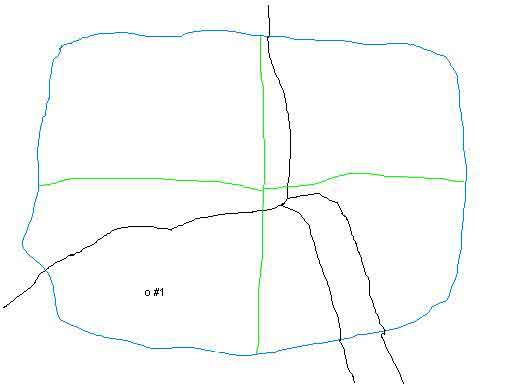 |
First, the nature, character and depth of the formation to which the wells will be drilled in order to drain this pool are determined. Then applying science and petroleum engineering to this data, the number of acres that one well drilled to that formation can be expected to drain is determined. Each well’s drainage area is called a “unit”. The unit boundaries are shown in blue in this image.
From the amount of acreage each well can drain, the minimum distance that there should be between the wells is calculated. This is called the “spacing”.
This well spacing requirement is then mandated uniformly to the known extent of the pool. (Acreage is still in the pool if it is still part of the same pressure system.)
This drawing shows, in blue, our 400-acre pool divided up into four 100 acre drilling “units”.
| Go directly to intro or slide: 1 2 3 4 5 6 7 8 9 10 11 12 13 14 15 16 17 18 19 20 21 22 23 24 24a 25 26 27 28 29 30 31 32 33 |